 EMODnet Product Catalogue
0.0022321 Arc minute
Type of resources
Available actions
Topics
Keywords
Contact for the resource
Provided by
Years
Formats
Representation types
Scale 1:
Resolution
-
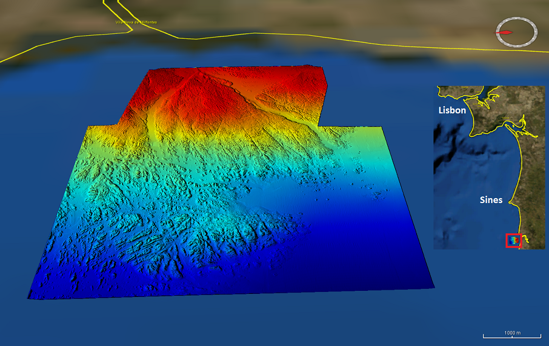
High resolution (1/448 minute ~ 4m) composite bathymetry dataset from the Mineplat 3 and Mineplat 4 cruises onboard IPMA RV Noruega. Portugal southern continental shelf, off Alentejo coast, 8 to 20 June 2018 and 24 March to 4 April 2019. Depths between 20 and 115m. During Mineplat 3 cruise high resolution multichannel seismics and magnetic data acquisition was performed during the daytime and multibeam mapping 24h/24h, with a Reson T50-P multibeam echosounder. Mineplat 4 cruise comprised seabed sediments sampling during daytime and multibeam mapping during the night. Depths are referenced to the Portuguese Chart Datum (2m below MSL), horizontal coordinates in the WGS84 reference frame. Position and attitude data (GNSS+Inertial via Applanix OceanMaster POSMV) was post-processed with POSPAC.